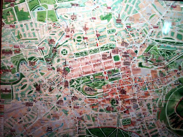
Map
In the middle are three parallel streets going SW to NE; that's New
Town. The bottom street is Princes Street, which fronts the drained
loch (the green area). Princes mall and the train station are at the
bottom of the loch. Below that, the Castle is on a hill. (The curved
streets in the green area surround it.) The Royal Mile is the long
road going east from the castle; it ends at the Palace of Holyrood on
the right (just barely in the picture), where Mary Queen of Scots
lived. The Royal Mile goes through the center of Old Town.
Two big hills, Arthur's Seat and the Acropolis, are off the map SE
and NE respectively. On the west side is a well. The long road that
goes off the map NE-ward to the port suburb of Leith.
Edinburgh, Scotland -- July 2002
Copyright © 1999-2004 by
Mike (Sluggo) Orr